Ghanzi
Ghanzi is a town in the middle of the Kalahari Desert the western part of the Republic of Botswana in southern Africa. The region is the country's pride in contributing a large portion towards the beef industry. In fact, Ghanzi farmers provides about 75% percent of beef exports, according to the Botswana Meat Commission, primarily to the United Kingdom and the European Union
At the time of the 2021 census, there are 21,420 people living in the town with another 6,900 nearby. Ghanzi is the administrative center of Ghanzi District and is considered the "capital" of the district, as it is the largest in terms of population and geographical measure. Ghanzi District measures 117910 km2 and is bordered by Ngamiland to the north, Central District to the east, and Kgalagadi and Kweneg Districts to the south. Its western border is shared with Namibia.
Other spellings of Ghanzi include "Gantsi" - which is more consistent with Setswana, the national language of Botswana - "Ghansi"; and "Ghantsi". It has also been purported that the various renderings of Ghanzi actually stem from the Naro language word "Gaentsii", meaning "gigantic swollen buttocks", referring to the body part of an antelope, and later cattle that congregated around a pan in the area.
Map - Ghanzi
Map
Country - Botswana
 |
|
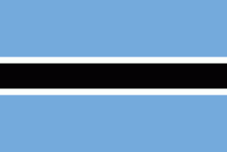
| Flag of Botswana | |
A country of slightly over 2.3 million people, Botswana is one of the most sparsely populated countries in the world. About 11.6 percent of the population lives in the capital and largest city, Gaborone. Formerly one of the world's poorest countries—with a GDP per capita of about US$70 per year in the late 1960s—it has since transformed itself into an upper-middle-income country, with one of the world's fastest-growing economies.
Currency / Language
| ISO | Currency | Symbol | Significant figures |
|---|---|---|---|
| BWP | Botswana pula | P | 2 |
| ISO | Language |
|---|---|
| EN | English language |
| TN | Tswana language |


